The productive Pismo clamming beach is the long stretch of hard-packed sand that runs from Grand Avenue in Grover Beach south through Oceano, continuing along the Oceano Dunes coast for miles. The most-visited section, and the one most clammers think of as "the clamming beach," is the strip between two named beach access points: Grand Avenue in Grover Beach and Pier Avenue in Oceano. Clams extend further south of Pier Avenue along the Oceano Dunes — the publisher has worked the entire stretch and reports the beach currently loaded. North of Grand Avenue is a different situation; see § 05 below.
This page covers how to reach the beach, where the productive sand sits, what is open and closed at any given time, and the practical questions of fees, parking, creek crossings, and driving on the sand.
Vehicle access closed south of Arroyo Grande Creek
Following a U.S. District Court ruling on April 9, 2026 in Center for Biological Diversity v. State Parks, the Oceano Dunes State Vehicular Recreation Area is temporarily closed to motor vehicles south of Arroyo Grande Creek. The closure took effect April 14, 2026 and addresses Endangered Species Act violations involving western snowy plovers and California least terns nesting on the dunes.
What is still open: vehicle access remains permitted on the beach between Grand Avenue and Pier Avenue, and on the stretch from Pier Avenue south to Arroyo Grande Creek. Foot access south of the creek remains open in most areas, subject to seasonal nesting-area fencing (March 1 through September 31).
The closure is expected to remain in place until State Parks completes a Habitat Conservation Plan and U.S. Fish & Wildlife Service issues an incidental take permit. A pending environmental impact filing in late May 2026 may begin to resolve the regulatory situation. For current status, refer to the State Parks Oceano Dunes page.
The Two Beach Entrances
The drive-on portion of Pismo State Beach has two named entrances, both at the foot of named streets in adjacent towns. Both lead to the same continuous stretch of sand. Both have day-use kiosks that collect a small per-vehicle fee. Both have free walk-in parking nearby for clammers who prefer to walk down to the beach without driving on it.
Grand Avenue, Grover Beach
The northern beach entrance. Drive west on Grand Avenue through Grover Beach until the road ends at the kiosk. The Grover Beach Day Use Area is the large free parking lot just before the kiosk — clammers walking onto the beach can park there at no charge. ADA-accessible restrooms are at the kiosk, and beach wheelchairs are available free at the entrance station on a first-come, first-served basis. From the kiosk, vehicles may drive south along the sand toward the Pier Avenue entrance.
Pier Avenue, Oceano
The southern entrance. Drive west on Pier Avenue through Oceano. The Oceano Dunes District Visitor Center sits at 555 Pier Avenue, just before the kiosk — a worthwhile stop on a first visit, with exhibits on Pismo clams, the dunes ecosystem, and the cultural history of the area. The Oceano Campground is adjacent. ADA-accessible restrooms and beach wheelchairs are available at the entrance station.
Hours and fees
Both entrances are open daily from 7 a.m. to 10 p.m. for vehicle day use. The day-use fee is $5 per vehicle as of this writing. Walk-in access is free. Fees and hours are subject to change; the Pismo State Beach and Oceano Dunes SVRA pages are authoritative.
Beach Map
The map below shows the two beach entrances, the strip between them, the Arroyo Grande Creek crossing, and the area currently closed to vehicles. Pinch and zoom on mobile, or open the full map in Google Maps via the link in the corner.
The Strip Between the Entrances
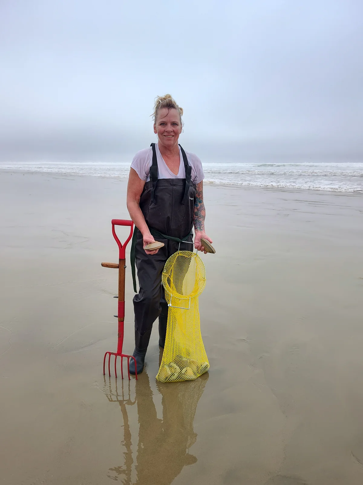
The roughly one-mile run of beach between Grand Avenue and Pier Avenue is the practical heart of Pismo clamming. It is the stretch most visitors think of as "the clamming beach" because it is the most accessible, the most-driven, and historically the most-worked. It is also currently producing well: the publisher has dug clams along its full length and reports that as of this writing the strip is loaded.
The terrain is consistent across the strip: hard-packed wet sand at low tide gives way to softer dry sand higher up the beach. The productive clam band runs in a relatively narrow strip from below the high-tide mark out to roughly knee or thigh depth on a typical low. The How to Clam page covers how to find that band and work it.
One observation about working this stretch: clammers tend to bunch up. On a good low tide it is common to see a cluster of two or three dozen people in one quarter-mile stretch and almost no one a few hundred yards down. The sand a quarter-mile away is the same sand. Walking past the cluster is often the most productive thing a new clammer can do.
South of Pier Avenue
The beach continues south of Pier Avenue for several more miles — through the dunes ecosystem and into what is, on paper, the Oceano Dunes State Vehicular Recreation Area. Historically this is where the dune-driving community ran ATVs, dune buggies, and 4×4s through both the open beach and the high dunes inland. Clams have always been present on this stretch as well, though it has seen lighter clamming pressure than the strip up north because most clammers concentrate near the entrances.
The publisher has worked this stretch extensively and reports the same robust clam population running well past the creek. What changes south of Pier Avenue is access — not the clams.
Vehicle access south of Pier Avenue continues only as far as Arroyo Grande Creek under current rules; everything beyond the creek is closed to motor vehicles for the duration of the regulatory situation described in the closure card above.
Foot access south of the creek remains open in most areas, subject to fenced nesting-area exclusions during the snowy plover and California least tern nesting season (March 1 through September 31). The mesh fencing is conspicuous — bright nylon netting with regular signage — and is intended to keep people and dogs out of nesting zones, not off the beach entirely. A clammer willing to walk in from Pier Avenue can reach productive sand south of the creek on foot at any time of year, with the caveat that the walk gets longer as the tide drops.
North of Grand Avenue and the Pismo Pier
North of Grand Avenue, vehicles are not permitted on the sand. The beach continues north past the Pismo Pier, becoming progressively narrower as the cliffs of the Wilmar / Shore Cliff stretch take over. This stretch — sometimes called Atascadero Beach where it lies between Grand Avenue and the pier — is reachable on foot from the Grover Beach Day Use Area lot at Grand Avenue, from the North Beach Campground in Pismo (399 South Dolliver Street), and from the boardwalk and stairs near Addie Street.
This stretch is open beach — pleasant for walking, surf fishing, and watching the city pier from a distance — but the published convention from local sources is that clam harvest is concentrated south of Grand Avenue, not north. The phrasing across regional and city tourism material is consistent: "the proper place to clam is south of Grand Avenue." Whether this reflects active CDFW regulation, a residual restriction from the historical Atascadero Beach Pismo Clam Preserve, or simply long-standing local practice is not always clear from public sources.
Verify before harvesting north of Grand
Before clamming anywhere north of Grand Avenue or anywhere near the Pismo Pier, confirm current rules with CDFW or with rangers at the Oceano Dunes District Ranger Station: (805) 473-7220. Posted closure signs at the Pismo Pier and on the beach near Grand Avenue should be respected. The site does not encourage harvest in any area where local regulations or convention restrict it.
For practical purposes, every clammer this site is written for — first-time visitors, returning regulars, anyone planning a session around a published low tide — should plan to work the beach south of Grand Avenue. That stretch is unambiguously open, well-known, and currently producing well.
Arroyo Grande Creek
Arroyo Grande Creek is a small year-round watercourse that crosses the beach south of Pier Avenue and empties into the surf. Its flow varies with rainfall and with releases from Lopez Dam upstream. In summer and dry-season conditions the creek is often a thin sheet of water that cars can drive through without difficulty. After winter storms or scheduled releases, the flow can rise to a depth and velocity that makes it impassable to vehicles.
State Parks closes the crossing to vehicles when flow reaches roughly twelve inches in depth or any time conditions make it unsafe. The closure may be marked with signs at the crossing or simply enforced by rangers at the entrances. Drivers planning to head south of the creek — under normal access rules — should check the creek before committing to a crossing. Getting stuck in a flowing creek is materially worse than getting stuck on dry sand, both for the vehicle and for the surrounding habitat.
This advice is currently moot in the practical sense: under the active vehicle closure, the creek is the southern limit of where any vehicle can go. Clammers on foot can wade across the creek without difficulty in most conditions, with appropriate care for slippery rocks and current.
Parking, Fees, and Logistics
The two free walk-in parking options are the Grover Beach Day Use Area at the foot of Grand Avenue, and the lot adjacent to the Oceano Campground area near Pier Avenue. Both are paved lots with restrooms and a short walk to the sand. A clammer who does not need to drive on the beach can avoid the day-use fee entirely by parking in either lot and walking down. Many regulars do exactly this.
The drive-on day-use fee is $5 per vehicle at either kiosk, paid by credit or debit card; cash is no longer accepted at most California State Park entrance stations. The fee is per visit, not per hour. There is no separate clamming permit — the legal requirement is a California sport fishing license (covered on the Regulations page), not a beach access permit.
Camping is available at three places nearby. North Beach Campground in Pismo Beach (tent and RV, no hookups) and Oceano Campground at the south end (tent and RV with some hookup sites) are reservable through ReserveCalifornia. Beach camping inside the Oceano Dunes SVRA was historically available on the open sand south of Pier Avenue but is currently affected by the same vehicle closure described above; the SVRA page is the current authority on what is reservable.
Driving on the beach: what to know
Pismo State Beach is one of only a handful of California beaches where vehicles may legally drive on the sand. The kiosk operator collects the fee, hands over a paper pass for the dashboard, and waves the vehicle through. From there, the rules are mostly those of common sense and ordinary traffic law applied to an unusual surface.
Any street-legal vehicle is allowed; four-wheel drive is strongly recommended but not required. The hard-packed wet sand near the water is essentially a low-friction roadway and will hold any vehicle. The trouble is the soft, dry sand higher up the beach, which routinely traps two-wheel-drive cars and any vehicle whose driver tries to climb a slope or stop in deep dry sand. Many drivers air down their tires to roughly 18–20 psi for traction on the soft sand and re-inflate at the gas station on the way out.
The most common stuck-vehicle scenarios are predictable: trying to drive up onto the soft sand from the wet sand; parking too close to the water as the tide comes in; and stopping on a slope without momentum. Bring a shovel. Rangers will not tow, and a tow truck on the beach is expensive when one can be found. A modest tow strap, a shovel, and traction boards or floor mats will recover most stuck situations.
One additional note specific to clamming: a vehicle parked on the wet sand should be moved well above the high-tide line before the harvester starts working. Tides come in faster than people expect, and a salt-water bath is not what the truck signed up for.
Seasonal Considerations
The clamming year at Pismo has a clear seasonal shape, even if the clams themselves are present year-round.
Tides
The deepest minus-tides occur in winter and again in summer, on different schedules. Winter low tides happen during daylight hours, which is what most clammers want. Summer minus-tides tend to occur in the middle of the night. The Tide Almanac filters all daylight clammable lows for the current and next year.
Nesting season
From March 1 through September 31, snowy plovers and California least terns nest on the open sand and in the dunes. Mesh fencing is erected to protect nesting areas. The fencing does not cover the entire beach — it surrounds known nest clusters. Clammers should respect the fences absolutely. The plovers nest directly on the sand and a single careless footstep can destroy a clutch. The current closure described above is in part a response to the fact that, even with the fencing, plover mortality has been higher than the Endangered Species Act allows.
Weather
Coastal fog is common from late spring through mid-summer. The fog often burns off by late morning, but on some days it sits all day. Afternoon wind comes up most days year-round and can make the working surface miserable. Mornings are generally calmer than afternoons, which conveniently aligns with most of the daylight low tides anyway.
Crowds
Holiday weekends and the prime winter low-tide series draw the largest crowds, especially on the strip between Grand and Pier. Arriving early — an hour or so before low tide — lets a clammer pick a spot before the cluster forms.
Other Central Coast Locations
Pismo clams range historically from Half Moon Bay south to Baja California, but the Pismo Beach / Grover Beach / Oceano stretch covered above is by far the densest historical population and the practical center of the recreational fishery. This site focuses on that stretch.
Other beaches along the Central Coast — Avila, Morro Bay, Cayucos, San Simeon, Cambria — have different shellfish species, different productive zones, and in some cases different regulations. Razor clams, gaper clams, geoducks, and littlenecks are not Pismo clams and are not what this site covers. Anyone clamming outside the Pismo Beach area should consult the CDFW invertebrate regulations directly for the species and location they intend to harvest.
Updates and Authoritative Sources
Conditions on Pismo Beach change. Tides, weather, and water quality change daily. Regulatory access changes on the timescale of months to years — the current closure is one example. The publisher reviews this page periodically and updates it when material changes occur.
For information that may have changed since the last review, consult the original sources directly:
Authoritative Sources for Current Conditions
Pismo State Beach (parks.ca.gov): hours, fees, campground reservations, current closures. parks.ca.gov/pismo
Oceano Dunes SVRA: vehicle access, OHV status, beach driving conditions, day-use limits. parks.ca.gov/OceanoDunes
Oceano Dunes Ranger Station: (805) 473-7220
CDFW Marine Region: regulations, license requirements, emergency closures. See the Regulations page for full citations.
This page reflects conditions as of the date shown in the footer below.